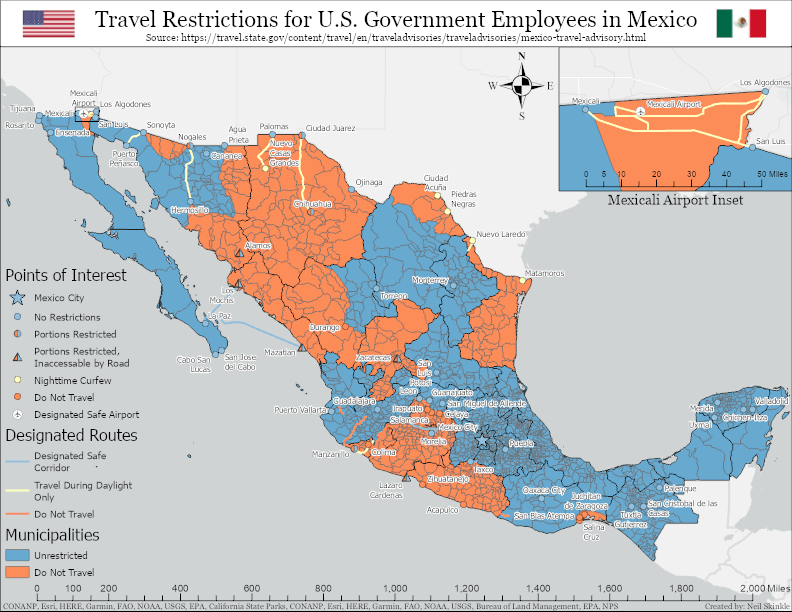
This map was created using the U.S. state department travel advisories website, specifically the section outlining travel restrictions for U.S. Government employees. Areas and routes are either designated unrestricted, nighttime curfew, or restricted. Most boundaries are defined by federal highways such as “U.S. government employees may not travel west and south of Federal Highway 45 in Durango state”.

Leave a comment