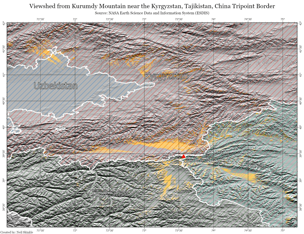
This is a viewshed from the peak of Kurumdy mountain near the Kyrgyzstan, Tajikistan, China tripoint border. The terrain data comes from NASA’s Shuttle Radar Topography Mission, and can be accessed from Derek Watkins’ website. I created an observer at the peak of the mountain, then generated a viewshed using the Data Elevation Model provided by Watkins. I was surprised the viewshed extended all the way to Uzbekistan’s Fergana valley.

Leave a comment